
Inspired by Canal by Canal, Special Collections has created two displays on view in the Special Collections Reading Room through June 30, 2022, that focus on the broad themes of water, sustainability, and natural resources.
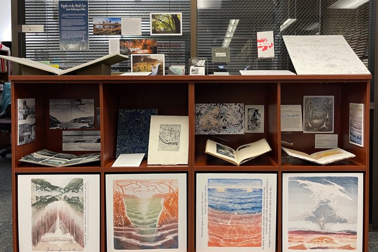
Ripples in the Mind’s Eye: Artists Reflecting on Water
No shortage exists of writers and artists dealing with water in their work—it’s the tempestuous home of fickle gods and strange, otherworldly creatures as often as it’s a calm, tranquil mirror or an ever-changing babble.
In this exhibit, artists and writers reflect on water in various ways. Documentary views along two rivers provide glimpses at how the waterways shape the surrounding areas. A water cycle is reimagined into a detailed diagram of the complex and unsustainable ways water flows into and out of an urban center. Writings that capture the ocean as a major driving force—even as a character—are paired with wildly different artistic interpretations. Creation myths rooted in falling water are recounted and imagined and the poetic ruminations of an artist on the connectedness of all things are accompanied by prints that capture the vastness of the watery landscape.
Mapping Natural Resources
“You cannot see the Grand Canyon in one view … It is a region more difficult to traverse than the Alps or the Himalayas, but if strength and courage are sufficient for the task, by a year’s toil a concept of sublimity can be obtained never again to be equaled on the hither side of Paradise.”
—John Wesley Powell

The books and images in this exhibit focus on survey work undertaken by John Wesley Powell, a geology professor at Illinois State Normal University, now known as ISU. Over the course of several trips across several years Powell explored along the Colorado River and the Grand Canyon. Powell’s project, the Geographical and Topographical Survey of the Colorado River of the West, yielded numerous books containing reports and sometimes records from his daily journals.
Many other books, photographs, maps, and other resources related to the themes explored in these exhibits are available for research in Special Collections. For more information about these exhibits or if you would like to schedule a class visit to Special Collections, please contact Rebecca Fitzsimmons at rlfitzs@IllinoisState.edu.
The early 1800s saw a rise in industrialization that had placed new demands on natural resources, making the prospect of a scientific assessment of mineral wealth a priority for the United States. Thus arose the Great Surveys that led to the formation of the U.S. Geological Survey.
