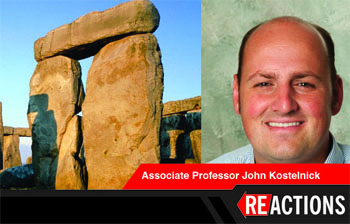
Reactions is a new column seeking faculty reactions to news and issues.
The recent discovery of underground caverns at Stonehenge have put new light on the advances 3-D mapping can bring to disciplines from archeology to city planning. Associate Professor of Geography John Kostelnick talks about the doors opening with 3-D mapping.
Recently, a new three-dimensional map of the landscape beneath and around the Stonehenge site was created that revealed up to 17 additional monuments or structures buried beneath the iconic stone monoliths.
Detailed 3-D mapping is adding new insights into how we understand the world around us, including how we interpret archaeological sites such as Stonehenge. High resolution 3-D mapping technology, such as ground penetrating radar (GPR) and 3-D laser scanners, were used to generate the new map that displayed these findings in stunning detail for the first time.
Digital mapping technologies, such as those used at Stonehenge, are increasingly employed by archaeologists and historians for related purposes, such as detailed mapping of artifacts on a Civil War battlefield to better understand how events unfolded during the course of the battle.
The benefits of 3-D mapping have been discovered in many other disciplines beyond archaeology. For example, Light Detection and Ranging (LiDAR), which generates 3-D maps of the Earth’s surface similar to how SONAR can map an ocean floor, is commonly used by foresters to find gaps in a forest canopy caused by diseased trees, or by energy analysts to identify rooftops in a city with the ideal combination of roof pitch and directional orientation suitable for installation of solar panels.
Urban planners today commonly develop sophisticated 3-D maps of their cities, often detailed enough to show individual fire hydrants along a street, to better visualize the current layout of the city and to better plan for future development.
3-D mapping is the tip of a larger iceberg that represents a revolution in mapping driven by rapid technological developments in recent years. The “Mapping Revolution” is characterized by an explosion in maps around us today, everything from more accurate maps generated by Global Positioning Systems (GPS) to more convenient maps available on mobile phones and devices. The tremendous new detail on maps today gives us amazing new insights into our world, but also raises debate related to circumstances when mapping become so detailed that it creates privacy concerns.

